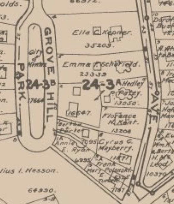
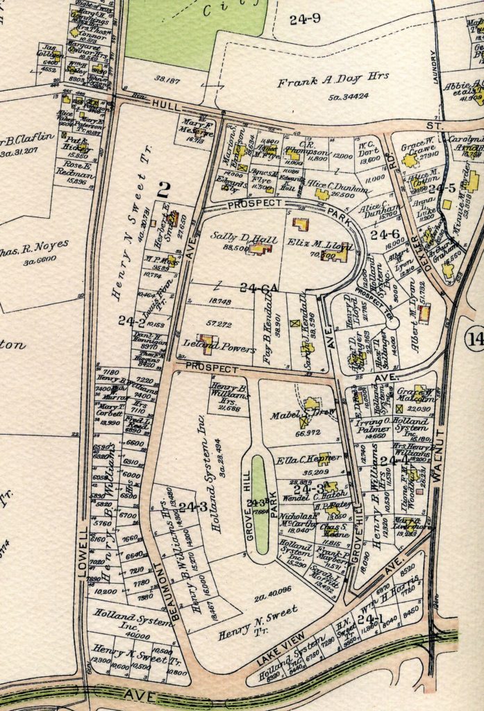
The house’s permit history shows a 1922 permit for a garage 13’6″ from the lot line. It is shown in the 1929 Newton City Atlas.
https://www.newtonma.gov/home/showpublisheddocument?id=796
kurtlewinhouse.priorfamily.org
History of 57 Grove Hill Ave
The house’s permit history shows a 1922 permit for a garage 13’6″ from the lot line. It is shown in the 1929 Newton City Atlas.
https://www.newtonma.gov/home/showpublisheddocument?id=796
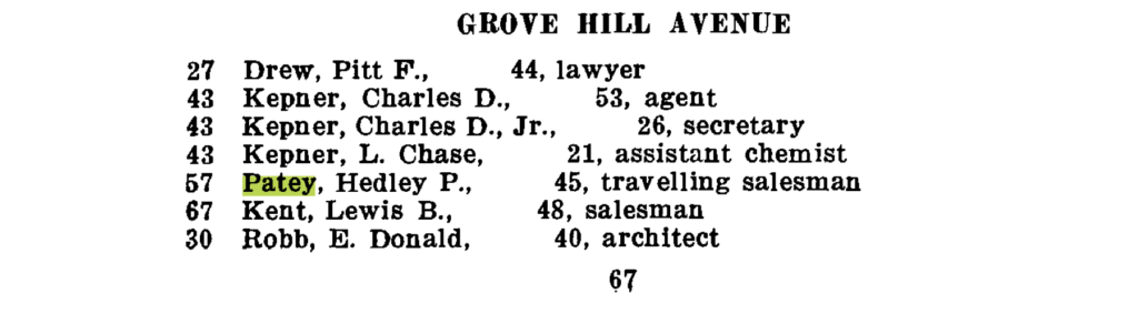
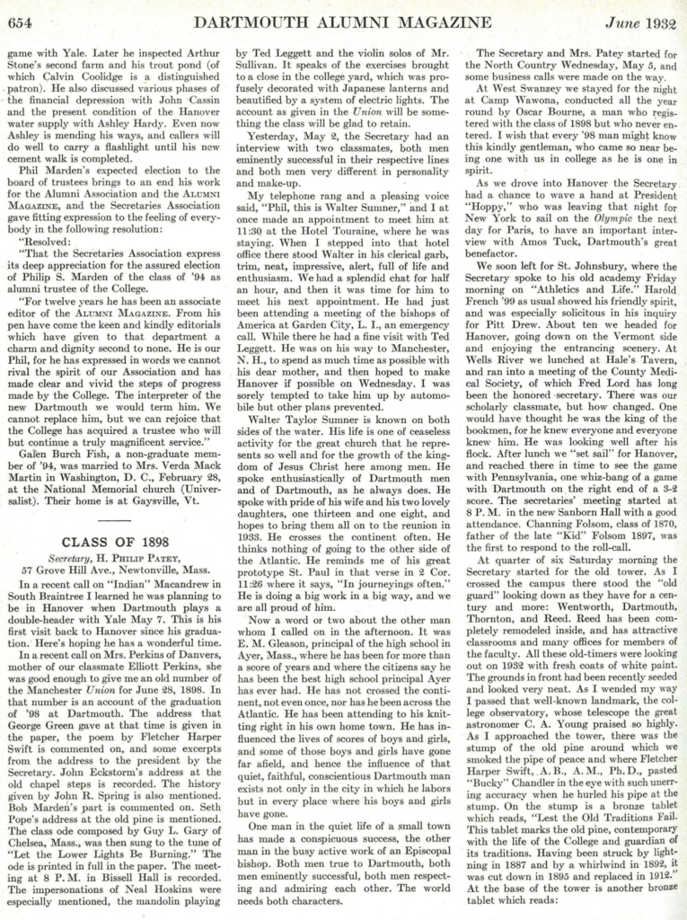
The 1920 City of Newton list of assessed polls lists Hedley Patey as a traveling salesman
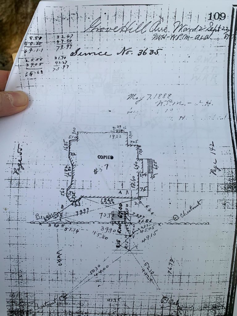
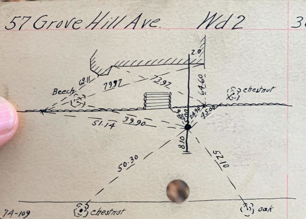
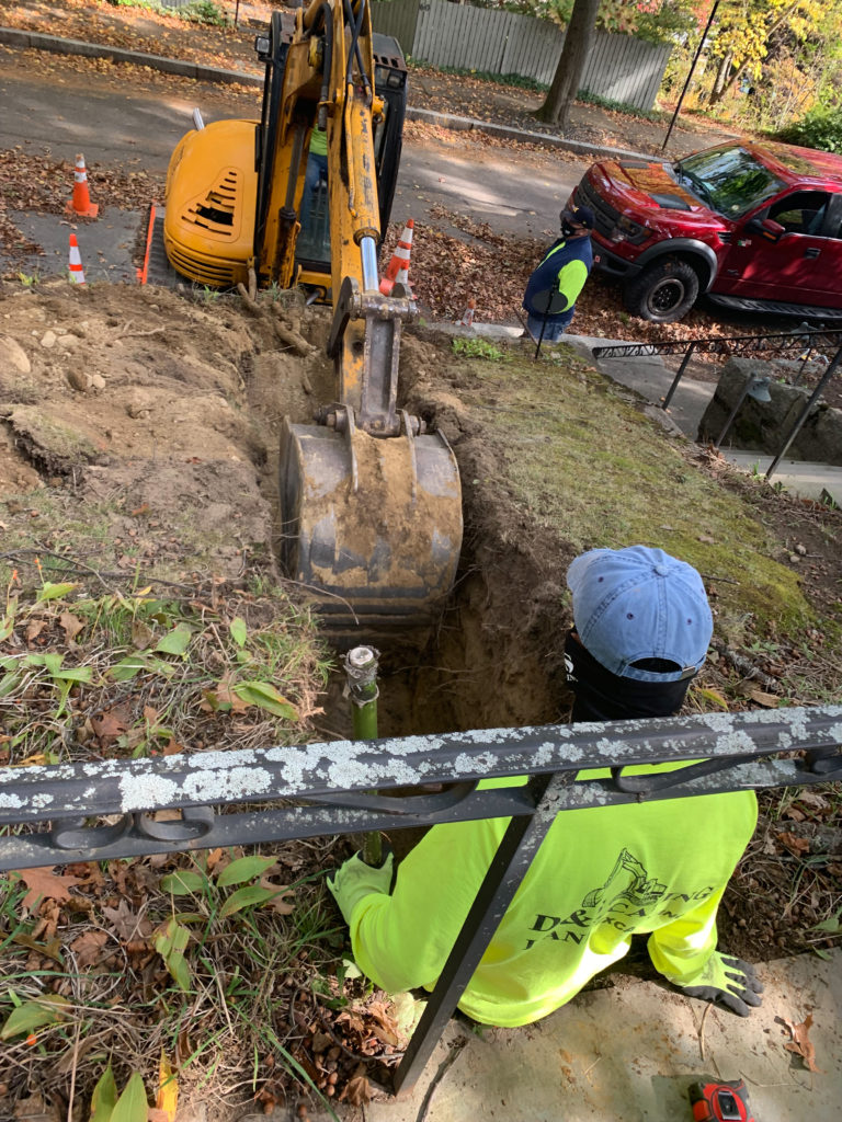
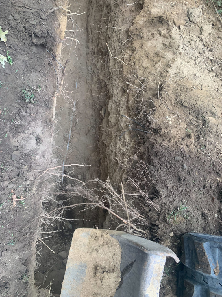
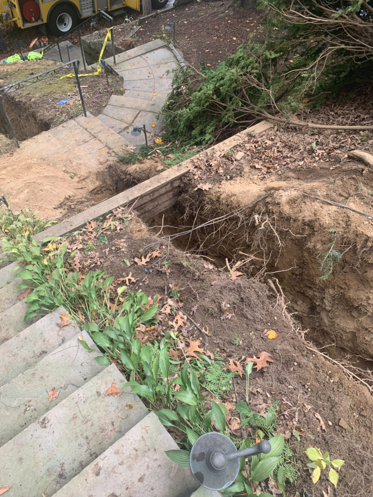
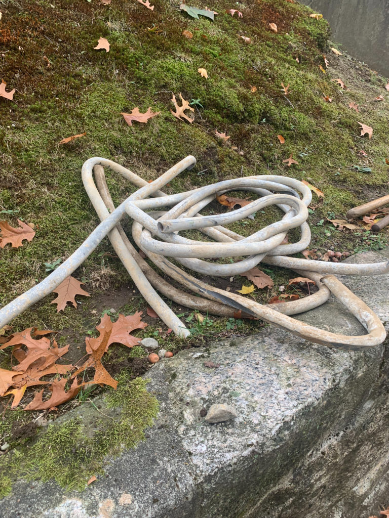
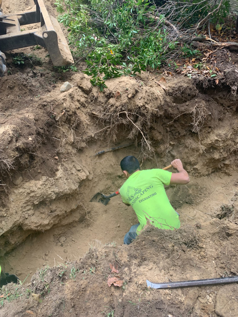
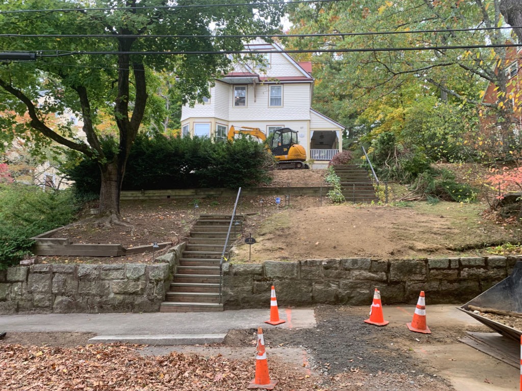
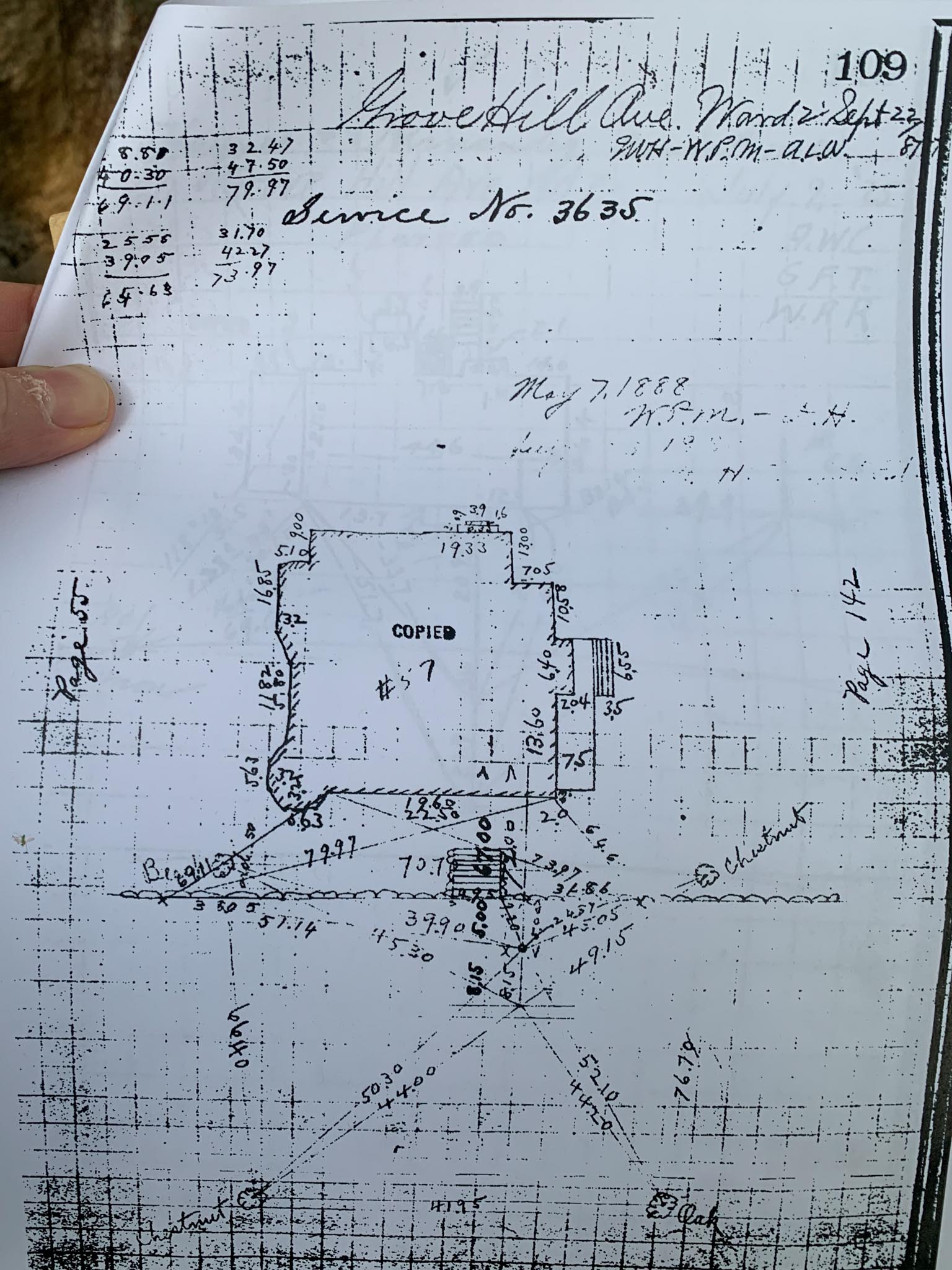
Below are shots of the city’s records of the water line installation for 57 Grove Hill Ave. Measurements were taken from trees, one of which still stands. The lead pipe was replaced with copper in 2020. The diagram has a May 7th, 1888 date. Perhaps the house waited for water until then?
This diagram probably has the most accurate measurements of the houses outside dimensions!
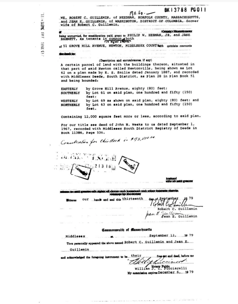
The adjacent 51 Grove Hill Ave was owned by Boston Artist Robert Charles Guillemin from 1967 to 1979. Robert was known as Sidewalk Sam (Wikipedia entry).
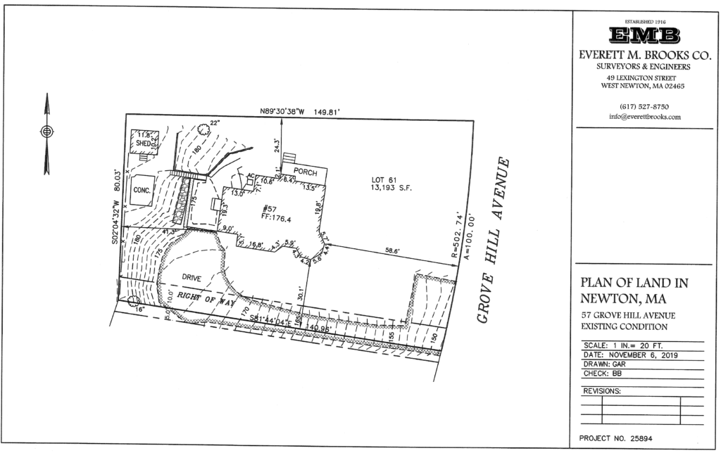
Here is a full 3D plot plan for the land done in 2019.
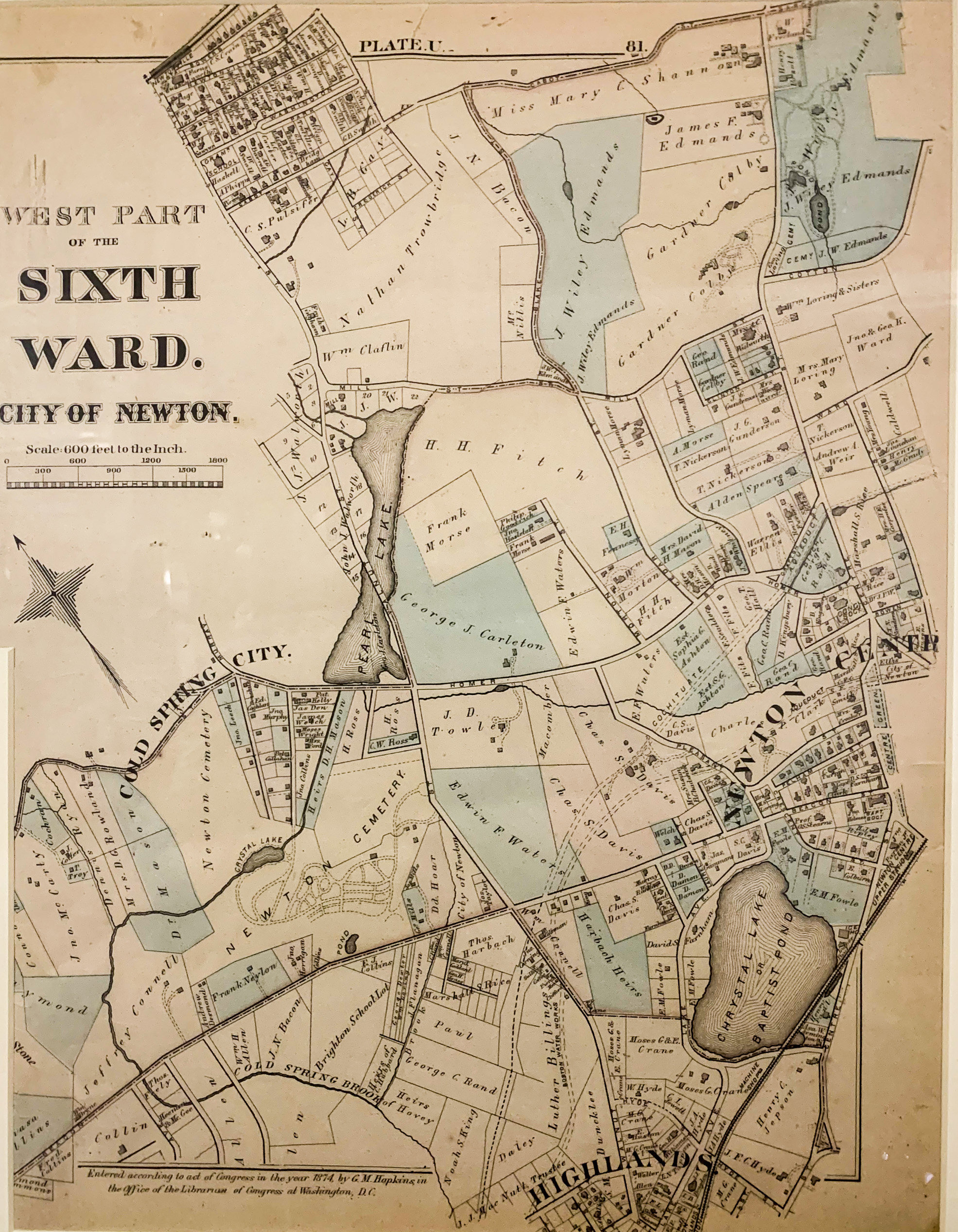
I’ve had this map in basement for years, but was always very disorienting to me. Now it comes together. The lower western shore of Pearl Lake is Lakeview Ave. The lower fifth of Pearl Lake is City Hall. Lowell Ave (or something very close to it) is Murray St. Crystal Lake is also known as Babtist Pond. There is a competing (much smaller) Crystal Lake in Cold Spring Park. Current dirt road Blake St is a major artery. No comm Ave.
Grove Hill Ave (if it existing would be in the lower right of the white space below “Sixth Ward, City of Newton”.
Thanks to a friend, here is an overlay of this map to current Newton:
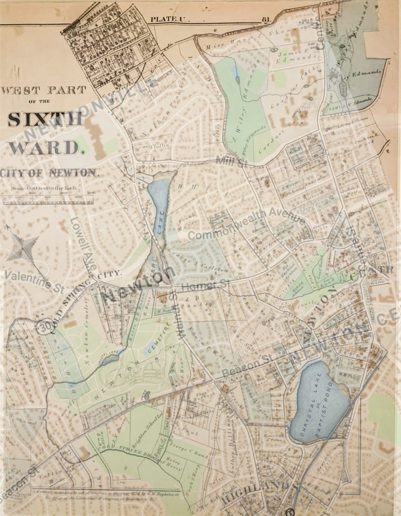
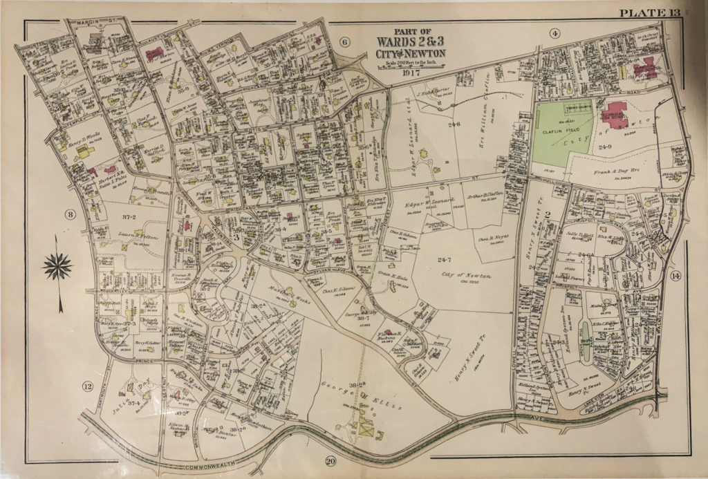
Here is a map from 1917. It differs significantly from the 1887 plan, with Comm Ave and Bulloghs pond coming into play and Murray Street named Lowell, and Morse named Dexter.
The neighboring house is still owned by Keene.
Above is a photo of the whole map (on our basement wall).
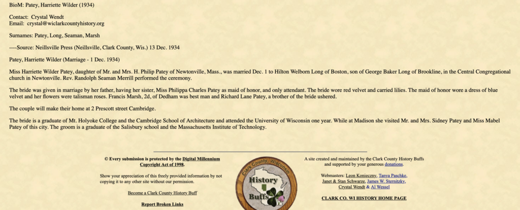
Harriette Patey was married to Hilton Long on Dec 1st, 1934
https://www.wiclarkcountyhistory.org/0data/18/18703.htm